You are here

Blogs

Week 1

6/8/09
I plated KG4@3pm@30°C(WT), KG15(helper)@3pm@37°C, KG18(tranposon)@3pm@37°C and incubated overnight

6/9/09
Experiment Design:

Glider Progress

The glider was sent the command to head for home last night and is now on track toward the Columbia River. The glider will come to a point 18 miles west and 6 miles north of the CR entrance and run a 2 km transect until we pick it up on Tuesday, June 2.

Deployed:5/17/2009
Mission Name:GHLINE.mi
Last Surface GMT:6/1/2009 14:26
Surface Reason:Timeout Expired
Last Position:4655.774N, 12440.911W
Waypoint:4624.0000N, 12430.0000W
Range (m):60479
Bearing ° :149

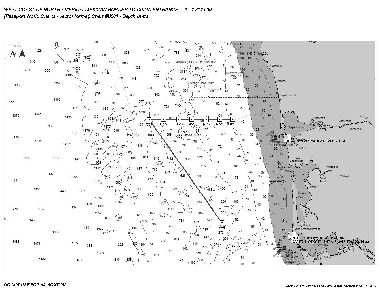
Glider route map


The map shows the deployment site and the route to the Gray's Harbor line, as well as the waypoints along the GHline. The glider will be leaving the GHline on Sunday for the deployment site where we will pick it up on Tuesday.

28 May 2009 – 100m Isobath survey.

 Because of threatening weather offshore we decided to leave the estuary a little early on the morning of the 28th.  We first went 15 miles offshore to dump our holding tank, and then begin our series of CTD casts down the one hundred meter isobath. The weather remained nice and we even had a following current down the coast causing us to complete our survey very quickly.

27 May 2009 – River sampling series.

At 0600 we replaced the long pump hose with a much shorter one to make it easier to prime the pump and get the water flowing.  David Needham set up a primary production measurement at 0700, and the water sampling team collected DNA and RNA samples and measured bacterial production.  Water sampling for methane, CDOM, and nutrients continued until 1200.  Then at 1500 we got underway and steam

Glider Progress

The glider hit a waypoint at about 1 am, and is halfway to the next one.

Deployed: 5/17/2009
Mission Name: GHLINE.mi
Last Surface GMT: 5/29/2009 14:22
Surface Reason: Timeout Expired
Last Position: 4659.190N, 12453.101W
Waypoint: 4659.5000N, 12449.023W
Range (m): 5202
Bearing °: 67

Glider Progress

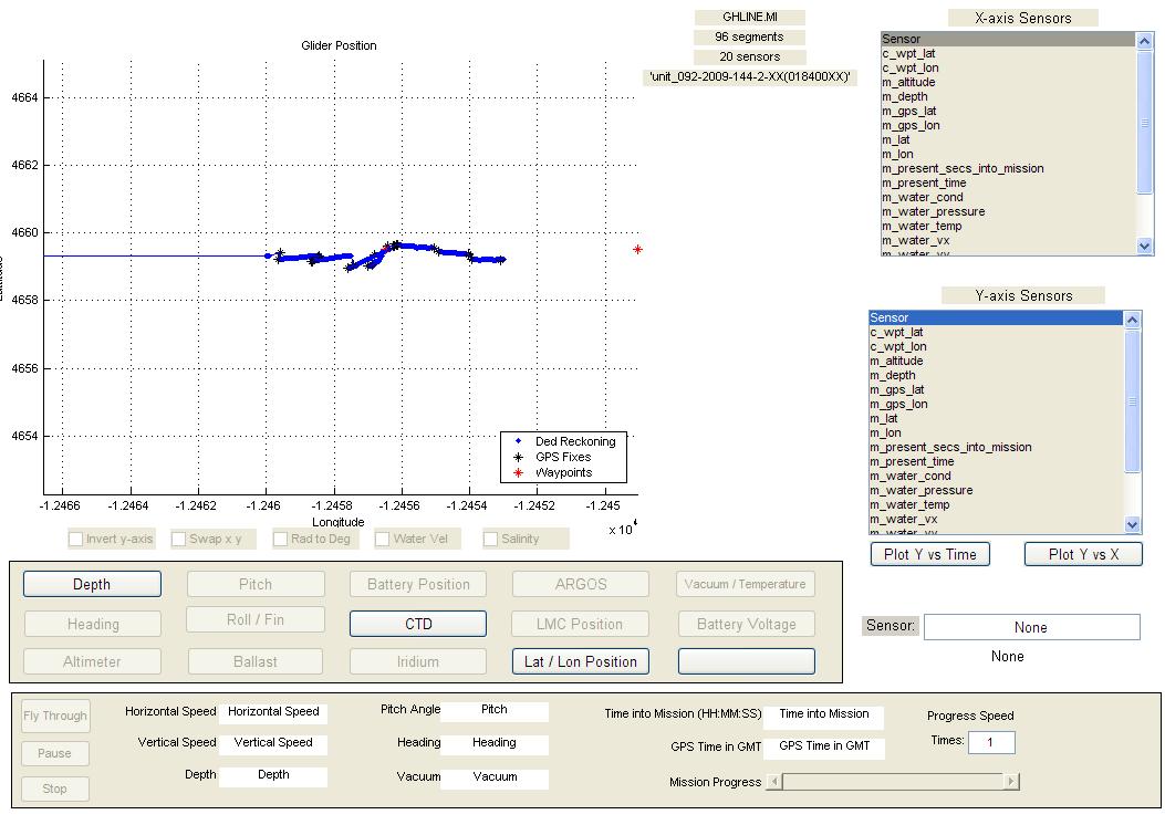
The glider surfaced at about 1330 this afternoon, on its way to the next waypoint.The attached image shows the CTD data for 81 segments or dives from the Gray's Harbor line.

Deployed:5/17/2009
Mission Name:GHLINE.mi
Last Surface GMT:5/28/2009 20:28
Surface Reason:Timeout Expired
Last Position:4659.404N, 12459.590W
Waypoint:4659.5000N, 12456.477W
Range (m):3950
Bearing ° :70

Glider Progress

The glider hit the third waypoint on the Gray's Harbor line this morning at about 7:15.

Deployed: 5/17/2009
Mission Name: GHLINE.mi
Last Surface GMT: 5/28/2009 14:18
Surface Reason: Hit a Waypoint
Last Position: 4659.311N, 12503.528W
Waypoint: 4659.5000N, 12456.477W
Range (m): 8946
Bearing ° : 71

26 May 2009 – Port call and Beaver Army dock.

We continued to collect samples at the RM-17 station hourly until 1000, and then pulled the anchor and went to the dock at the Job Corp campus on Tongue Point. Colleen Durkin and Sara Bender disembarked with their equipment, and undergraduate intern Lindsey Longway came aboard. We then steamed upriver to the Beaver Army dock at river mile 53, conducted a CTD cast, and then tied up at about 1800. We attached the end of the pump hose to a pole and strapped to the port side of the ship so that the hose end was positioned at 1m depth.

Pages

Subscribe to RSS - blogs